Introduction to Pathfinder
Pathfinder is a decision support system which implements a proven methodology to optimize the location and routing of infrastructure elements, taking into account spatial and cost constraints.
The Pathfinder methodology
The following diagram describes the typical steps followed with Pathfinder.
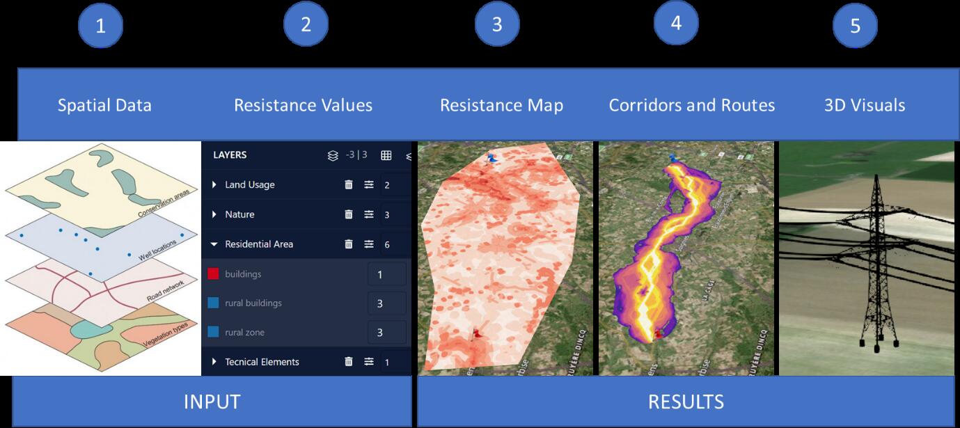
In a first step, relevant spatial data, representing constraints for the routing, are identified and imported into the application. A project is created for a specific study area and it typically contains start and end points for the routing.
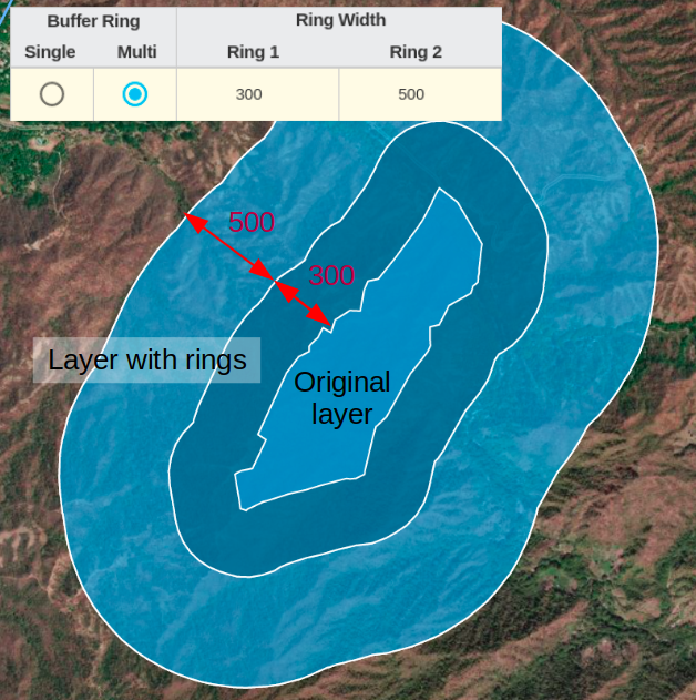
Next, spatial data layers are assigned parameters representing their suitability for the infrastructure (e.g. power lines). These parameters are ring distances and resistance values and should take into account regulations, costs and other planning constraints.
The ring distances define areas of influence around the original data layers, and are used to assign different resistance values depending on the distance.
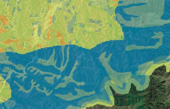
The resistance values define how suitable a layer area is for the location of the infrastructure (e.g. being crossed by powerlines and placing their pylons) and they usually have different values for each layer ring.
Based on these scenarios, Pathfinder runs a multi-criteria decision analysis (MCDA) to calculate the resistance map for the entire planning area.
The resistance map is the basis for Pathfinder to identify a corridor map and optimal paths within the planning area.
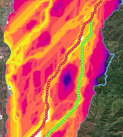
The results can be evaluated quantitatively and visually on the map or 3D view, and exported to georeferenced files.
Using Pathfinder’s Web Application
The same Pathfinder account credentials used to access the ArcGIS addin can also be used to login into the Pathfinder web application. In fact, all the projects created from the ArcGIS addin can be accessed in this web application.
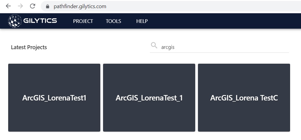
If you ArcMap document is named “Area1”, then you can find the corresponding project in Pathfinder as “ArcGIS_Area1”:
Read the Pathfinder’s user manual if you want to use the web version of Pathfinder and take advantage of its advanced features.
Disclaimer: the scenarios depicted in this manual do not represent actual customer projects or infrastructure proposals, and are presented for demonstration purposes only.
For more help, please contact Gilytics.